


Here Comes the Thunder
Colorado and the Denver area are facing severe weather threats
David Kent
(David Kent/Fort Worth Star-Telegram/MCT)
May 7, 2014
According to a forecast done by 9News Weather, Colorado is at an increased risk for fire and severe thunderstorms.
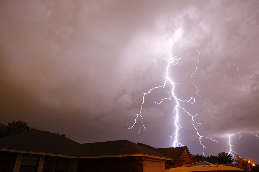
Isolated thunderstorms are likely to happen from early afternoon until late Thursday. While there will not be a large amount of storms, those that do occur are predicted to be very heavy with hail, strong winds, heavy rain and possible tornados. Lighter showers and cloudy skies will be common until early tomorrow afternoon.
These storms are ranging from the plains to all the way east in Nebraska and Wyoming. Southeastern Colorado has been issued a Red Flag warning in light of strong gusts of wind occurring there. The rest of the area in the path of the storms are currently in a severe thunderstorm watch, which will end when the storms do. Tornado warning have been issued across the state.
Aurora itself is currently cloudy and windy with the humidity above 10%. No warning has been issued and is predicted to have rain without the severe weather the rest of Colorado may be seeing. However, if report the following right away if seen to a news station or your emergency department:
Funnel-shaped clouds that reach the ground
Greenish-purplish skies
Hail
Trees shaking more than usual
Winds reaching above 45 miles per hour